-
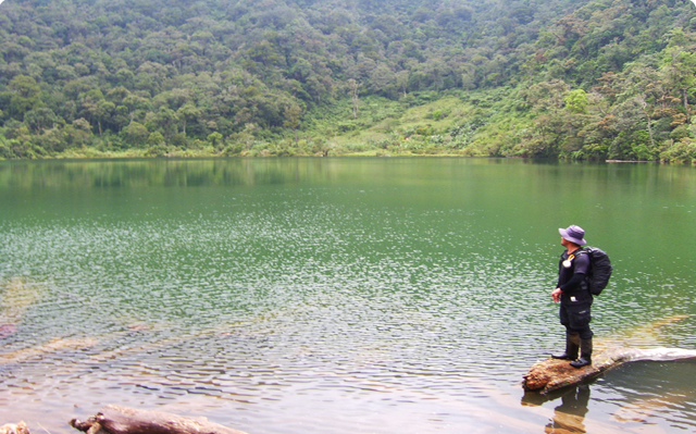 Lake Duminagat
Brgy. Lake Duminagat, Don Victoriano, Misamis Occidental -
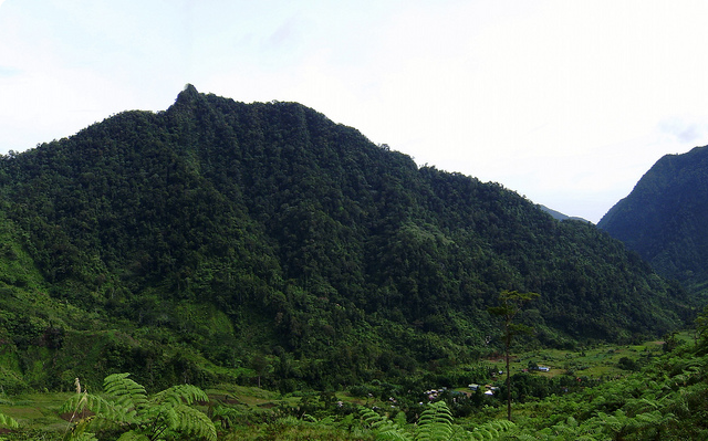
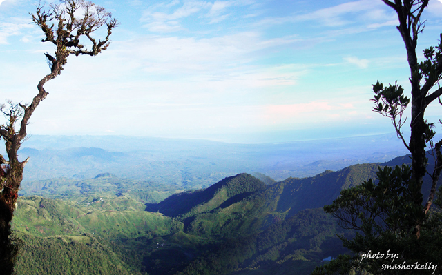 A birds eye view of Mt. Malindang Range Natural Park
-
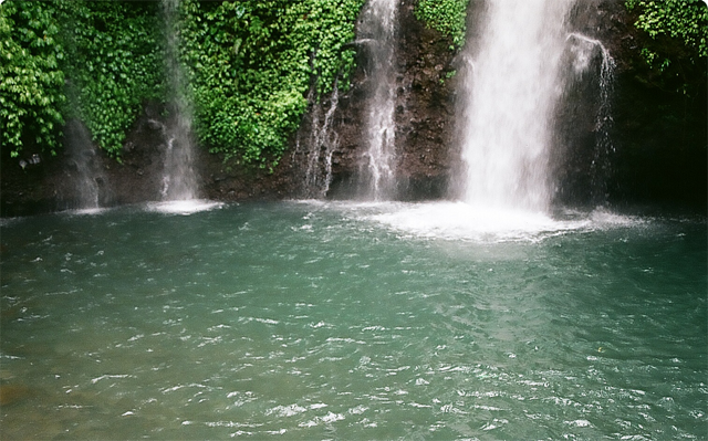 Guiban Falls, Concepcion, Misamis Occidental
-
 Panoramic view of Brgy. Lake Duminagat, Don Victoriano, Misamis Occidental
-
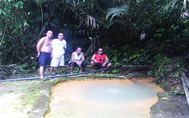 Hot Spring of Brgy. Sebucal, Oroquieta City, Misamis Occidental
Discovering Beauty - Mt. Malindang and its environs
Mt. Malindang Range is now believed to be an extinct volcano. A series of volcanic eruptions over some two million years followed by a severe erosion has formed the deeply dissected mountain range of lavas and ash built-ups. People simly need to see the eight-hectare crate lake of Duminagat, immerse themselves in the hot springs of Secubal and Tuminawan, and marvel at the extensinve distribution of volcanic rocks and carbonized woods at Mansawan, to be transported back to tis fiery past.
Today, Mt. Malindang's rugged terrain has a vast landscape extending over 174,385 hectares of land. Forest lands cover some 33,700 hectares of which almost 18,000 hectares are primary growth forest. It is home to 2,283 recorded species of plants and animals, excluding numerous species of invertebrates and micro-organisms that have not yet been documented. A substantial number of weed, crop and tree species grow in the remaining areas of open land, mainly marginal, grass, shrub and cultivated lands, coconut groves and reforestation sites.
Mt. Malindang Range has about 15 major catchments and 17 rivers emanating from its peaks and draining to the coastal zones of Misamis Occidental and Zamboanga. Seventeen majoy rivers arise from this crater, precipatation causes a continous runoff of large quantities of water following a radial drainage pattern. The fast flowing water over steep slopes cut into the landscape forming deep gullies.
These unique landscapes, tremendously rich species diversity, and overflowing wealth of water, provided the indigenous Subanens and oter local residents a paradise they consider home. Mt. Malindang's irresistible allure has drawn a diverse mix of migrants from different parts of the country from as far away north as Bohol, Cebu and Siquijor. Thus, a complex mingling of indigenous Subanen and migrant is found within and around Mt. Malindang.
Sadly, Mt. Malindang's beauty is fading fast. Its forest cover is shrinking. Its unique species are in danger of extinction. Its people are being sucked into the turbulent whirlpool of poverty and desolation. Consequently, they are forced into making difficult choices of preserving their heritage for future generations on one hand, and meeting their immediate needs at the expense of a degraded environment on the other.
Mt. Malindang is threatened by rapid loss of biodiversity. To protect the mountain, Presidential Decree 28 was issued in 2002, which re-classified it as a natural park with a core of 34,694 hectares declared for strict protection. In 2004, Mt. Malindang became a full-fledged protected area, through Republic Act 9304.
This is the story of the Dutch of the north meeting the Filipinos of the south, and how together they unleashed the immeasurable power of the collective human spirit. All it takes is an impassioned few, driven not by personal gain, but by the pure and simple desire to bring hope to a marginalized indigenous people and the unwavering faith that all life forms are worth savng.
Mt. Malindang is both a challenge and an opportunity, for a people faced with the risk of losing their natural treasure, to finally find the strength and the courage to build their own mountain of hope and a sea of dreams. (Source: Endangered Beauty-SEARCA)
Finding Beauty - Mt. Malindang Range Natural Park
From the north, a traveler in Southeast Asia can immediately recognize the Philippines as an archipelago made up of a vertically aligned group of some 7,107 islands covering a total land area of 300,000 square kilometers. Moving further down south, one can unmistakably identify Mindanao, the second largets island in the country that convers an area of 94,640 square kilometers. Its topography is rugged but rises gently to form the slopes of the Mt. Malindang Range.
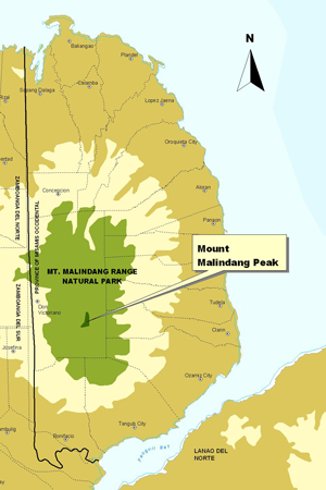
The Mt. Malindang Range, withthe crater lake of Duminagat, covers of the provinces of Zamboanga del Sur and Zamboanga del Norte, and much of Misamis Occidental (8°07' and 8°28' latitude and 123°32' and 123°45' longitude). Misamis Occidental is located in the eastern part of the Zamboanga Peninsula. It is bounded on the northeast by the Mindanao Sea, east by the Iligan Bay, southeast by the Panguil Bay, and west by Zamboanga del Norte and Zamboanga del Sur.
The Mt. Malindang Range includes Mt. Malindang itself (2,424 meters above sea level or mASL), North Peak (2,183 mASL), South Peak (1,850 mASL), Mt. Sumalarong (1,782 mASL), Mt. Ampiro (1,532 mASL), and Mt. Labag (1,537 mASL).
The mountain enjoys a mild humid tropical rainforest climate known as Type II (Modified Coronas Classification), where rainfall is more or less fairly distributed throughout the year. The wettest month is November and the driest month is February. Although outside the typhoon belt, the area is not sheltered from north-easterly (Amihan) and trade winds, and is sometimes hit by freak storms. It has an annual rainfall ranging from 1,700 to 2,500 milimeters and a relative humidity of 80 percent that rises to as high as 90 percent near the mountain tops. Temperatures register at mean values of 26-28°C along the coast. It is hottest from April to June but temperature can drop to a daily mean of 15°C at higher altitude. (Source: Endangered Beauty-SEARCA).