-
 Welcome to MMRNP Official Website
-
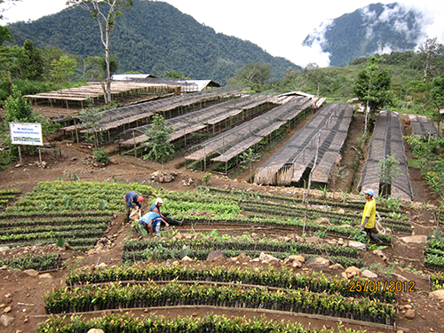
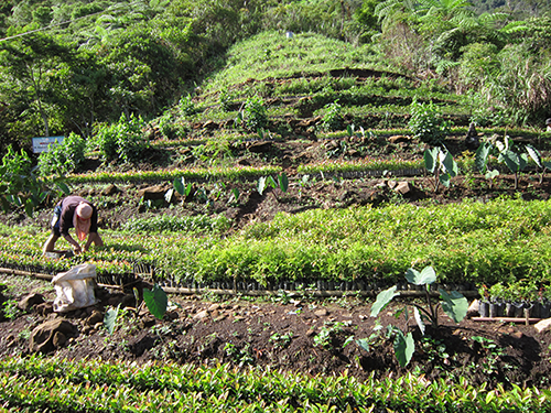
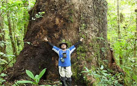
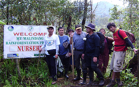
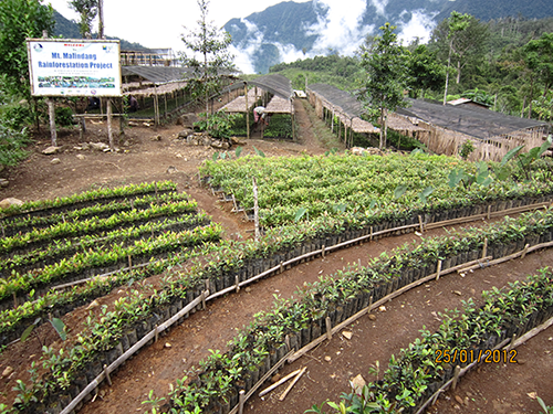 Mount Malindang Nursery Area
-
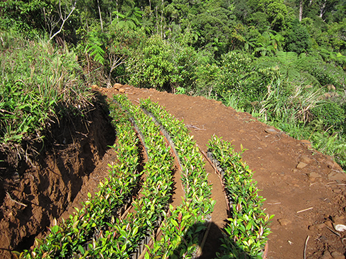
 Mount Malindang Nursery Area
-
 Mount Malindang Nursery Area
-
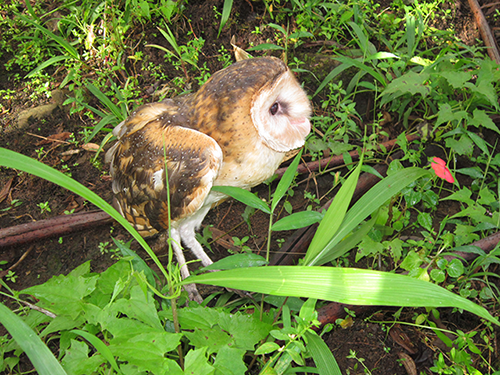
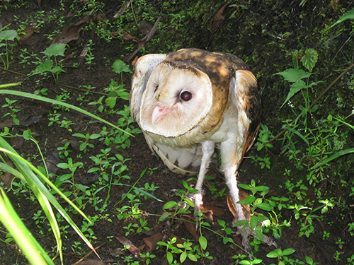 New Found Owl Species
-
 Help PROTECT - Mt. Malindang Range Natural Park
-
 Join now and support...Mt. Malindang Range Natural Park
-
 Help and support the life sustaining watershed of Mt. Malindang Range Natural Park
-
 Join now and support...Mt. Malindang Range Natural Park
-
 Be part in protecting the Mt. Malindang Range Natural Park
-
 Help and support the life sustaining watershed of Mt. Malindang Range Natural Park
-
 Join now and support...Mt. Malindang Range Natural Park
-
 Help and support the life sustaining watershed of Mt. Malindang Range Natural Park
-
 Be part in protecting the Mt. Malindang Range Natural Park
-
 Help and support the life sustaining watershed of Mt. Malindang Range Natural Park
-
 Help PROTECT - Mt. Malindang Range Natural Park
OFFICIALS

RAPHAEL P.M. LOTILLA
DENR Secretary
DENR Secretary

DR. HENRY A. ADORNADO
Regional Director
Regional Director

HON. HENRY S. OAMINAL
Provincial Governor
Provincial Governor

REY S. FERNANDEZ
Protected Area Operation Superintendent (POSu)
Protected Area Operation Superintendent (POSu)
MMRNP-PAMB VISION »
An ecologically-balanced ecosystem in the region with economically stable communities living in a disaster and climate change-resilient environment for all life forms inspired by environmentally committed MMRNP PAMB.
MMRNP-PAMB MISSION »
To protect Mt. Malindang biodiversity and sustain its watershed value through responsible stewardship and partnership to improve the quality of life of all life forms therein.
Core Values : »
* Respect for all life forms
* Integrity
* Objectivity
* Collaboration
Goals : »
1. To protect, conserve and preserve the biodiversity and ecological balance of Mt. Malindang Range Natural Park
2. To actively engage the Subanen to become one of the key players in Mt. Malindang conservation and protection
3. To improve and strengthen partnership with MMRNP stakeholders
4. To generate resources for sustainable development in Mt. Malindang
Published Articles : »
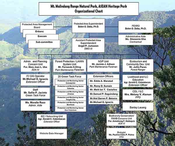
MMRNP-Organizational Chart»
REPORTS AND DOCUMENTATIONS
LATEST NEWS AND UPDATES ::
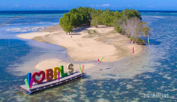
Collaboration forged between Department of Environment and Natural Resources and Misamis University for Marine Ecosystem and Coastal Biodiversity Protection: Updating of Baliangao Protected Landscape and Seascape Protected Area Management Plan 2023 to 2032
Date: March 11, 2022 4:00 P.M.
The Baliangao Protected Landscape and Seascape (BPLS) is a 315.50 hectare protected area that lies in Danao Bay, located in the Municipality of Baliangao, Misamis Occidental which is currently managed by BPLS Protected Area Management Board (PAMB) organized in October 4, 2001. It is an integrated ecosystem of mangroves, seagrass, riverine and coral reef which was declared as protected area under the Expanded National Integrated Protected Areas Act (ENIPAS) of 2018 Act or the Republic Act 11038 in July 24, 2017 pursuant to Proclamation No. 418. Its establishment as a protected area began when Danao Bay was chosen as the site for marine protection program by PIPULI Foundation in 1991. It started as a 74- hectare sanctuary that greatly contributed to the improvement of fisheries in Danao Bay as a result to the collective efforts of the foundation, some local fishers, the church and the local government. Even though initially, the marine sanctuary did not gain much support from the community, but the PIPULI Foundation persevered together with the strong support of Mayor Agne V. Yap, and continued its implementation and eventually received support from the community during the process. It later led to a municipal resolution declaring a 150-hectare sanctuary in Barangay Misom called the Misom Sea Sanctuary project which later became the BPLS. The Protected Area is about 5 kilometers from the town proper and is accessible by land and water transportation. Networks of barangay roads and trails or a ride on a motorized boat from the four (4) component barangays can lead you to the interiors of the PA. The BPLS component barangays are Misom, Sinan, Tugas and Landing.
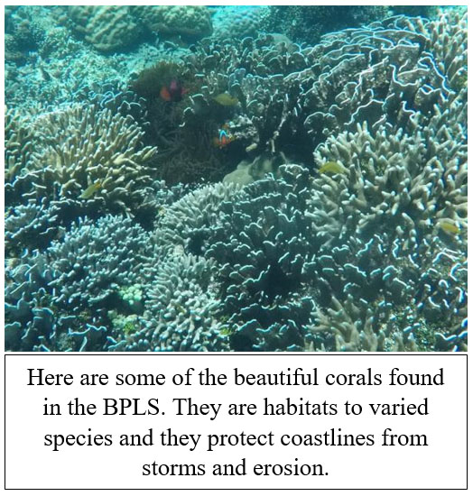
Establishment and effective management of marine protected areas is one way to preserve and promote marine and coastal biodiversity. Marine Protected Areas (MPAs) with its variety of ecosystems have many purposes and benefits. The mangroves and coral reefs serve as barrier ecosystems that protect us from the effects of natural disasters, MPAs are also safe breeding grounds for varied species most especially for key threatened species. MPAs also contribute greatly to renewing biodiversity and sustenance of growing human population. Locally, the Municipality of Baliangao is known by its beautiful white sand beaches, islets, and bountiful seafoods, including all tourism services the BPLS provides, attracting tourists from all over the province and even from the neighboring provinces, thus providing opportunities, jobs and income for locals
Although oceans cover 70% of our planet, it is faced with threats mostly caused by human activities, including effects of climate change. In the Philippines, coastlines are inhabited by more than 60% of the total population (DENR et al. 1997) and coastal areas are the prime tourism destination that comprised to 80% of tourism activities, (tourism.gov.ph, retrieved last February 8, 2022). Some intrusive human activities are overfishing, destructive fishing, illegal, unreported and unregulated fishing, and land-based pollution, among others. Although the restrictions of COVID-19 are giving a halt to tourism activities in BPLS and surrounding areas, preparation and effective management to address the persistent, present and incoming issues are essential in the management of protected and ecotourism areas.
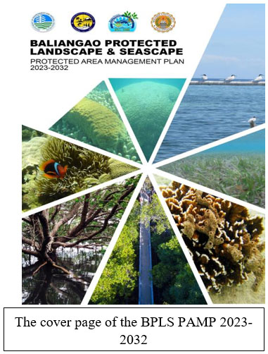
With this, Misamis University, through Misamis University Community Extension Program (MUCEP) undertook a Contract of Undertakings with the Department of Environment and Natural Resources (DENR) through the Protected Area Management Office (PAMO) of BPLS represented by DENR PENRO Rey S. Fernandez, and BPLS PAMO PASU For. Alson D. Potutan last June 7, 2021 for the updating of BPLS Protected Area Management Plan (PAMP). The signing transpired in the respective offices of the signatories in compliance with the COVID-19 IATF protocols. The updating of the BPLS PAMP were based on the issued Technical Bulletin 2018-06 “Clarifying the Protected Area Management Planning Process and Providing the Annotated Outline for Protected Area Management Plans”. The BPLS PAMP were prepared for the effective protected area management and address the present and future issues and management problems of the PA. The BPLS PAMP contains the Description of the BPLS, Current and Proposed Program, BPLS Threats, Issues and Concerns, Situational Analysis, Baliangao Protected Landscape and Seascape Protected Area Management Plan and the Monitoring and Evaluation Plan
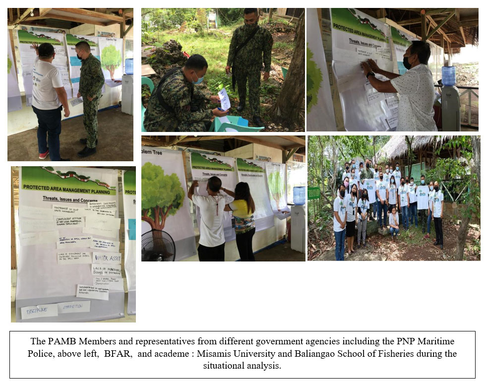
To achieve a participatory approach in the preparation and revisions of these plans, the MUCEP Office, led by EnP. Grace. V. Villanueva, along with her staff, For. Jersam C. Calago, For. Bobby B. Alaman, Goldah Grace D. Sultan and Hanzen D. Tomatao, with BPLS PAMO staff led by PASU Alson D. Potutan, Phoebe Jane R. Aque, Jane Medija, Ranger Domingo M. . Donggon, facilitated series of consultation meetings, planning and workshop with the BPLS Protected Area Management Board (PAMB) who were at the forefront of planning the activities, and in the over-all design of BPLS PAMP & ETMP proposed strategies, programs, and projects.
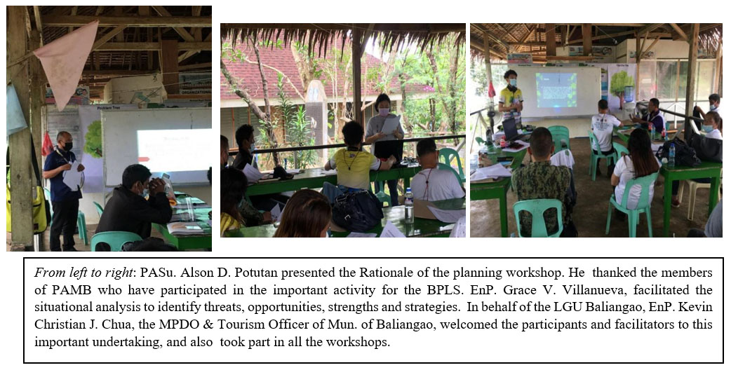
The planning workshops and situational analysis participated by the BPLS PAMB disclosed the pressing problems on natural ecosystem, human system, and management system of BPLS and likewise generated the mitigating measures through identified objectives, strategies and opportunities. With this, the BPLS PAMP would like to achieve these:
Vision: |
"The Baliangao Protected Landscape and Seascape (BPLS) aims to uphold the biodiversity conservation and protection, fosters education and research for sustainable ecosystem to become a top ecotourism destination providing recreational activities that support community livelihood for present and future generations through the strengthened effective and efficient management of PAMB, in collaboration with the local government units and the local communities." |
Mission: |
"To effectively and efficiently manage the natural resources of BPLS through collaboration with all stakeholders in the context of biodiversity conservation, ecotourism and sustainable development ." |
Goals:
1. To protect, conserve and preserve coastal and marine resources species biodiversity of BPLS for sustainable
utilization;
2. To strengthen collaboration and partnership among key players and stakeholders of BPLS;
3. To maximize the benefits of responsible ecotourism activities for sustainable development of
BPLS; and
4. Integration of Plaridel Bato Bird and Fish Sanctuary to BPLS.
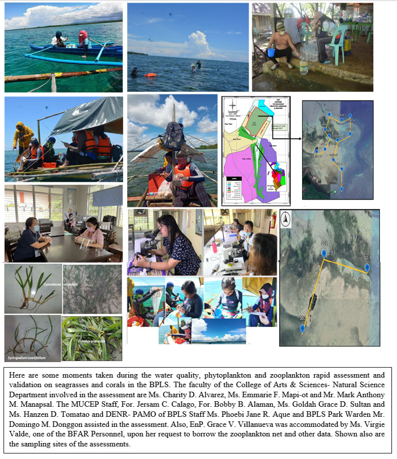
Primary and secondary data were also utilized in the revision of the plans such as the BPLS Ecotourism Management Plan 1st Edition, BPLS General Management Plan 3rd Edition, Profile of BPLS, results of BPLS Management Effectiveness Assessment (MEA), Socio- Economic Assessment and Monitoring System (SEAMS), BPLS Biodiversity Assessment & Monitoring System (BAMS), maps shape files, CLUP, LCCAP and DRRMP, MEMP of the Municipality of Baliangao and BDP of 4 BLGUs adjacent to BPLS. To supplement the data of BPLS BAMS, Misamis University College of Arts & Sciences- Natural Science Department faculty, namely, Ms. Charity D. Alvarez, Ms. Emmarie F. Mapi-ot and Mr. Mark Anthony M. Manapsal, conducted a Rapid Assessment on water quality, phytoplankton and validation on seagrasses and corals in the park. The assessment was also supported by the Bureau of Fisheries and Aquatic Resources (BFAR) by lending the zooplankton net. The results of the analysis provided additional inputs that are pertinent to the profile of the park including the identified threats & recommendations endorsed to the PAMB which were then incorporated in the plans.
These joint endeavours were successfully undertaken due to the support and funding of the Department of Environment and Natural Resources - Protected Area Management Office (DENR-PAMO) BPLS led by PENRO Rey S. Fernandez. Heartfelt acknowledgement to the BPLS PAMB for their invaluable support and efforts in crafting these plans. Also, to ENP. Kevin Christian Chua, and PASu Alson D. Potutan for the assistance in acquiring pertinent information valuable to the updating of the plans. Nevertheless, earnest acknowledgement is due to the Misamis University President, Dr. Karen Belina F. De Leon for the permission and support to the MUCEP staff to facilitate these activities.

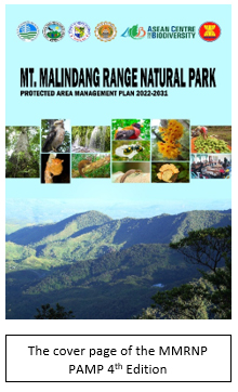
DENR and ASEAN Centre for Biodiversity (ACB) has partnered with Misamis University in advancing for effective protected area management: The MMRNP Protected Area Management Plan 2022-2032
DENR and ASEAN Centre for Biodiversity (ACB) has partnered with Misamis University in advancing for effective protected area management: The MMRNP Protected Area Management Plan 2022-2032
Hanzen D. Tomatao, MSDC/ Bobby B. Alaman, MPM-BCM Date: February 9, 2022 3:30 A.M.
The Mt. Malindang Range Natural Park (MMRNP) is the source of sustaining lives, communities, industries specially agriculture in the province of Misamis Occidental and parts of Zamboanga provinces. Due to its immense importance, MMRNP was declared a national park and watershed reservation in 1971 by virtue of RA 6266, and pursuant to the NIPAS Act, it was resurveyed and formally established as a Protected Area and its peripheral areas as buffer zones in 2000. Further, by virtue of RA 9003, it was declared as Mt. Malindang Range Natural Park. It is a watershed providing support to agriculture, industries, communities and households of the three provinces, and home of varied endemic wild species of flora and fauna, and with vast area of old growth forest that is a major long-term carbon sink.
All these precious and treasured resources that sustain lives also contributed to the declaration of Mt. Malindang Range Natural Park as the 29th ASEAN Heritage Park in 2011. Mt. Malindang as an AHP added to the network of established "protected areas of high conservation importance, preserving in total a complete spectrum of representative ecosystems of the ASEAN region." The inclusion of MMRNP contributes to one of the flagship program of the ASEAN which is the ASEAN Heritage Parks Programme, thereby will help achieve the mission of ACB to "generate greater awareness, pride, appreciation, enjoyment and conservation of ASEAN's rich natural heritage". Moreover, its presence will also lead to further collaborations and partnerships of AHP sites. Along with other protected areas, MMRNP is constantly exposed to different natural and man-made destruction and threats. As mentioned in the Protected Area Management Plan (PAMP) 4 th Edition, these threats that protected areas are facing include climate change effects, introduced species, visitor impacts, vandalism, poaching, pollution events, development and extractive activities, and extreme storms and wildfire. With this, it is imperative for policy makers, governing bodies and other partner stakeholders to be collaboratively responsive and visionary in planning effective strategies.
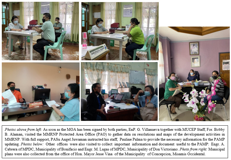
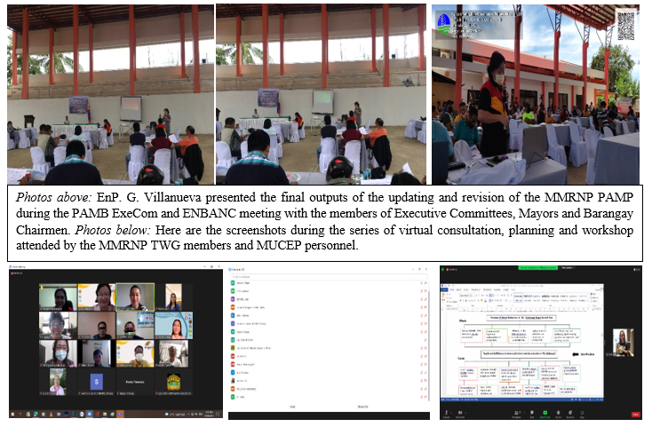
In June 7, 2021, Misamis University signed a Contract of Agreement with the Department of Environment and Natural Resources (DENR) and ASEAN Centre for Biodiversity (ACB) for the revision and updating of the General Management Plan, now called the Protected Area Management Plan (PAMP). The revision of the PAMP was mandated on the issued Technical Bulletin No. 2016-08 “Clarifying the Protected Area Management Planning Process and Providing the Annotated Outline for Protected Area Management Plans” from the Department of Environment and Natural Resources (DENR)- Biodiversity Management Bureau. Meanwhile, the ACB, whose mission is to facilitate regional cooperation and deliver capacity building services to the ASEAN Member States (AMS) in conserving biodiversity, has generously supported this endeavor by granting additional financial support. The PAMP is a blueprint intended for an effective management of Mt. Malindang and subsequently address the current and future MMRNP management problems and concerns. Through the Misamis University Community Extension Program (MUCEP) led by EnP. Grace V. Villanueva together with MUCEP staff For. Bobby B. Alaman, For. Jersam C. Calago, Goldah Grace D. Sultan, and Hanzen D. Tomatao, organized series of online and face-to-face consultation, updating and planning workshops attended by the Technical Working Group (TWG) members of MMRNP, and later by other stakeholders.
The revisions on the plan were the results of several reviews and workshops by the MMRNP TWG and information from the primary and secondary data from articles, MMRNP studies such as the SEAMS, BAMS 1, and 2, and published researches on MMRNP. Insights and recommendations from other reviewers were also incorporated. Also, other major sources of data in revising the PAMP were the various plans and programs from the provincial government, cities and municipalities such as the Comprehensive Land Use Plan (CLUP), Annual Investment Plan (AIP), Provincial Physical Framework Plan (PPFP), Ancestral Domain Sustainable Development Protection Plan (ADSPP), among others. This approach recognized the importance of consultative, iterative, and interactive planning.
The contents of the PAMP are based on the stipulated guidelines in the DENR TB No. 2016-08. The PAMP 4th Edition consisted of Executive Summary, Description of the Protected Area, Bio-Physical Profile, Socio- Cultural and Economic Profile, Current and Proposed Programs and Projects, and Threats, Issues and Concerns. Highlights in the PAMP are the key features or values of the protected area, stakeholders and their roles in the management, maps on biodiversity, values, and threats, and the situational analysis. As stated in the PAMP 4th Edition, it was identified in the situational analysis that there are various interrelated and deep-seated community-based policy, management, governance, and socio- economic issues that caused the emergence of the current core problem which is the "Lack of unified vision, collaborative actions, and resource sharing among stockholders towards protection of Mt. Malindang." To address these concerns and issues confronting MMRNP, the updated PAMP has these holistic and inclusive
Vision: |
An ecologically-balanced ecosystem in the region with economically stable communities living in a disaster and climate change – resilient environment for all life forms; and |
Mission: |
To protect Mt. Malindang biodiversity and sustain its watershed value through responsible stewardship and partnership to improve the quality of life of all forms therein. |
Moreover, it adheres to these Core Values: Respect for all life forms, Integrity, Objectivity and Collaboration. These are specifically defined by these Goals:
1. To protect, conserve and preserve the biodiversity and ecological balance of MMRNP;
2. To actively engage the Subanen to become one of the key players in Mt. Malindang conservation and protection, improve;
3. To strengthen partnership with MMRNP stakeholders; and
4. To generate resources for sustainable development in Mt. Malindang.
The persistent causes of these issues were identified by the TWG despite existing and previous programs and projects of DENR-PAO, PAMB and other partner stakeholders in MMRNP. Specifically, these are due to the lack of a comprehensive and updated MMRNP resource database, a deficiency in implementation of the previously identified provisions, passiveness of other PAMB members and instability of MMRNP PAMO technical staff focused on MMRNP, lack of coordination system and cooperation between LGUs and MMRNP communities, no clear demarcation on PA boundaries and insufficient management zones, scarcity of resources and budget for the implementation, lack of defined protection roles among Subanens and Ancestral Domain Sustainable Development Protection Plan (ADSDPP) for some Certificate of Ancestral Domain Claims (CADC), persistent poverty among growing MMRNP resident population, land speculation and perceived influx of wealthy migrants, and lack of alternative and sustainable livelihood and marketing support to existing livelihood. All of these identified problems and causes resulted to the "Presence of forest destruction, biodiversity loss and widespread poverty in MMRNP".
As quoted in the MMRNP PAMP 4th Edition, "Although the threats and weaknesses were many, strengths and opportunities likewise abound as evidenced by the MMRNP previous laws, plans, programs and projects. These strengths and opportunities included legal documents and administrative orders, dedicated previous and present DENR-PAO and PENRO staff, programs and projects by "some" committed MMRNP PAMB members, LGU, other agencies, and other initiatives by local POs, academe, and CSOs for MMRNP." Thus, updated MMRNP 2022-2031 PAMP contained the unified vision, planned collaborative actions and resource sharing among stockholders towards protection of Mt. Malindang.
These collective efforts in the preparation and revision of the MMRNP PAMP were made possible by the unceasing support and funding of the Department of Environment and Natural Resources – Protected Area Management Office (DENR- PAMO) spearheaded by PENRO Rey Fernandez. Sincere acknowledgement also to the ASEAN Centre for Biodiversity (ACB) through Dr. Theresa Mundita S. Lim for their generous support and assistance, and Ms. Rhia C. Galsim for the technical assistance.
Acknowledgement is also due to PASu Angel Jumawan and PAMO staff, offices of the Provincial Government of Misamis Occidental, NCIP, and LGUs for their full support and assistance in providing pertinent files. Nonetheless, a heartfelt appreciation to the Misamis University President, Dr. Karen Belina F. De Leon for resource sharing and permitting the MUCEP staff to facilitate and accomplish this partnership endeavor. Also, utmost recognition of the MMRNP TWG and other reviewers for their invaluable efforts, inputs, and contributions to the updating and revision of the MMRNP PAMP.
Some of us may not directly and immediately feel the effects of these issues and problems, but, should we wait for that time when all is too late? Threats that are identified in the MMRNP PAMP call for collaborative and participative response not only from policy makers and governing bodies but also from highland and lowland communities. A comprehensive and effective management of Mount Malindang Range Natural Park, will solve not only environmental protection and conservation issues therein, but also eliminate and mitigate threats to the culture, health and welfare of the people, industries, wellbeing of communities in Misamis Occidental and environs, as well as contribute to Sustainable Development Goals No. 1, 3, 6, 11, 13, 15, and 17 which are no poverty, good health and wellbeing, clean water and sanitation, sustainable cities and communities, climate action, life on land and partnerships for the goals respectively and finally address local impacts of climate change.
Misamis University Established Two Hectares Permanent Monitoring Plot in the Southern Part of Mt. Malindang Range Natural Park in Collaboration with DENR 10.
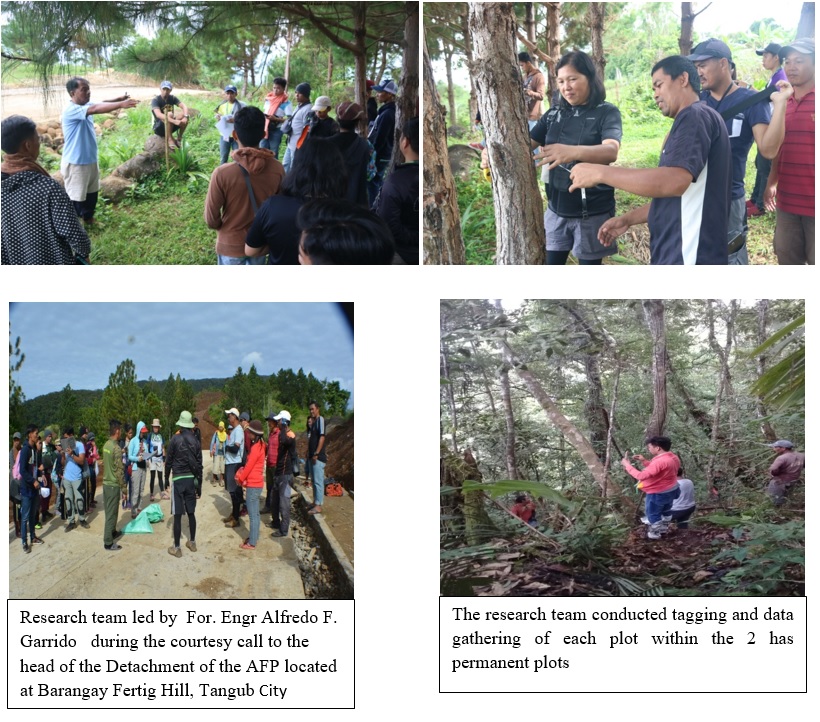
The Misamis University Community Extension Program (MUCEP) was again awarded a Contract of Agreement for CY 2018 by the Department of Environment and Natural Resources- (DENR) Provincial Environment and Natural Resources Office, Oroquieta City.The two hectares Permanent Monitoring Plots were established in the southern part of Mt.Malindang Range Natural Park in the province of Misamis Occidental to account its biological resources of the park. The said PMP will be the source of baseline information for the strict monitoring for the protection and conservation of these finite resources.
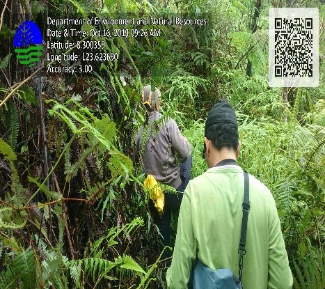
The 2 hectare permanent monitoring plot is required for Protected Areas per BMB Technical Bulletin No. 2017-09 and was established based on the BMB Technical Bulletin No. 2016-05. This activity is under Part V, which pertains to Biodiversity Monitoring, specifically in item 5.2.2, with the sub-title establishment of Flora monitoring plot. Thisprompted the establishment of the same in Mt. Malindang Range Natural Park in the forest area of Brgy. Fertig Hills (formerly known as Hoyohoy), Tangub City, located in the southern part of the Protected Area adjacent to the forest area where the biodiversity assessment was conducted last year. The procedure of Long-Term Ecological Research Network (LTERN) was utilized in this endeavor as required in the manual. Activities undertaken covered the establishment of the grid and marking of monuments and thereafter, the collection of data needed to generate the database.
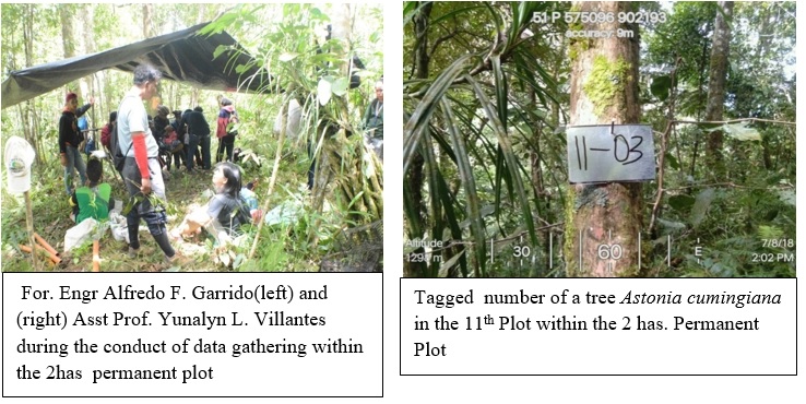
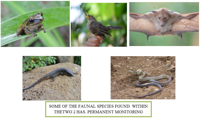
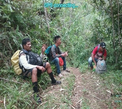
A composite research team composed of experts from Misamis University led by EnP. Grace V. Villanueva,together with the technical support staff:headed by For. Engr. Alfredo F. Garrido, Foresters Eden C. Pito, and Bobby B. Alaman, Biologist Ms. Yunalyn L. Villantes, Jonas T. Hingco, Mark Anthony Manapsal, It was supported by eight (8) DENR-MMRNP PA Office staff, Sixteen (16) BS Forestry practicumers from Jose Rizal Memorial State University (JRMSU) Katipunan Campus, and eight (8) hired residents jointly established the 2 hectares permanent plots. The establishment and gathering of data through assessment of the floral and faunal composition of the 200 plots within the 2 hectares Permanent Biodiversity Motoring Area (PBMA) conducted last July 9-30, 2018.
For. Engr. . A.F. Garrido created five teams in the field during the establishment of PBMA. To ensure that data gathering will be completed based on the scheduled timeline and maximum participation of each member of the research team. One team was assigned to conduct the layouts of the 200 plots. The remaining four teams composed of 5 to 6 members conducted floral assessment using GPS, compass, tape measure, nails, plain sheets, permanent marker pens, and forms. Data gathered includes the GPS reading of the corners and center of the plots, elevation, vegetation type, name of species, circumference, total height, merchantable height, bearing, distance, and remarks of the tree species inside the plots.
Gathered data were encoded and analyzed using software. For the faunal assessment nets, pitfall and traps were used to capture the different types of animals found within the two (2) hectares permanent plots. Captured fauna was recorded and released after the morphological structure of the faunas recorded.
Results of the floral assessment revealed a total of 5,009 individual trees recorded covering 150 species. The trees with a diameter greater or equal to 10 cm dbh constitute 39% or 1,941 trees, and for less than 10 cm dbh covers 61% or 3,068 trees. The different attributes of trees recorded in the flora field data such as total height and diameter at breast height (dbh). The merchantable height of trees were included for trees with 10cm dbh and above. The classification scheme developed by Fernando et al. (1998) used in the interpretation of the Shannon diversity index. The result of biodiversity index computation revealed that five quadrats (107,169,9,167,146 ) display a diversity index with relative values of High, 86 quadrats with moderate relative value, 85 quadrats for low and 24 quadrats for very low, respectively. Nevertheless, the biodiversity index for the 2.0-hectare monitoring plot is 3.7 with very high relative value.
The most dominant species include Shorea contorta, Lithocaprus philippinensis, Helicia sp, Cinnamomon mercadoi, and Syzygium sp. These species are also considered vital for it registered the highest importance values among species in the permanent monitoring plot.
There are eight (8) species listed under the International Union of Conservation of Nature (IUCN) with the following categories: Critically Endangered (6 species), Endangered (1 species) and Vulnerable (1 species). Under DAO 2017-11, five (5) species listed under the category of Vulnerable. The species categorized as critically endangered under the IUCN are Shorea contorta, Shorea squamata, Shorea negrosensis, and Shorea polysperma of Family Dipterocarpaceae.
Moreover, there are eight species considered by the locals as medicinal plants that can cure/ heal common ailments/diseases.These include Helicia Sp., Denrdocnide densiflora, Evodia bintoco, Lithocrapus sp., Ficus septica, Luecosyke capitellata, Melastroma malabrathricum, Nuaclea orientalis, and Villebrunea sp. An initial inventory was conducted to present the importance of these species to the community. The team highly recommended that a study on propagation and harvesting should be done for its sustainable use.
Faunal assessment disclosed a total of 125 vertebrate species recorded in the two-hectare permanent plot. These include 16 amphibians, 20 reptiles, 74 birds, and 15 mammals. Of the species recorded, 66 or 52.80% are endemics, of which 27 (40.91%) are Mindanao endemics. Furthermore, the study recorded six Malindang endemics, including one amphibian (Philautus surrufus) and five birds (Aethopyga boltoni malindangensis, Dicaeum anthonyi masawan, Dicaeum hypoleucum mindanense, Malindangia mcgregori and Turdus poliocephalus malindangensis). Of the vertebrates recorded, nine species composed of one endangered (Penelopides panini affinis) and eight vulnerable (Philautus acutirostris, Hydrosaurus pustulatus, Ophiophagus hannah, Otus gurneyi, Bubo philippensis, Actenoides hombroni, Buceros hydrocorax, and Sus philippensis) species considered endangered by the IUCN (2018). The DAO 2004-15 listed a total of 30 vertebrates (one critically endangered, 11 endangered (II), one endangered, eleven vulnerable, and six other threatened species). On the other hand, CITES (2014) also considered 19 species of vertebrates, of which 18 are assessed under Appendix II while one in Appendix I.
Misamis University, through the dynamic leadership of Dr. Karen Belina F. De Leon extends its sincerest thanks to DENR led by PENR Officer Rey S. Fernandez for the financial support in the undertaking of the said activity. MU is hopeful that the results of this assessment will be helpful to the DENR, academes, CSOs, and LGU for the protection and conservation of biological resources of Mt. Malindang. Further, the research team recommends that concerned LGUs will adopt the identified critically endangered species under Section 35 of RA 9147, also known as the Wildlife Act of 2001.
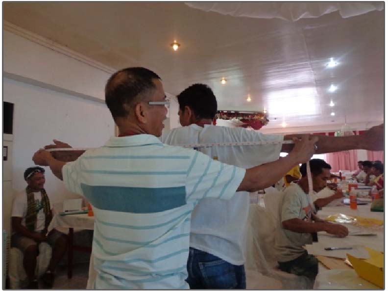
(Left) For. Engr. Alfredo F. Garrido conducted briefing of the research team before the conduct of the data gathering in the 2 has. Permanent plots at Barangay Fertig Hill, Tangub City and (Right) Assistant PASu Gloria P. Restauro assisted her staff in getting the correct dbh of the sampled tree.
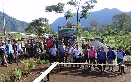
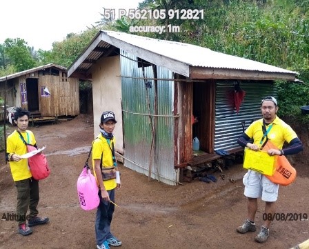
Misamis University was contracted by the DENR-MMRNP PAMB to identify a 60 km Management Zone inside Mt. Malindang Range Natural Park, Misamis Occidental.
The Misamis University Community Extension Program (MUCEP) again, was tasked by the Department of Environment and Natural Resources, Provincial Environment and Natural Resources Office, Oroquieta City, relative to the 2019 management zoning target of about 60 kilometers in length within the protected area of Mt. Malindang Range Natural Park located in the province of Misamis Occidental.
Mt. Malindang Range Natural Park (MMRNP) encompassing the province of Misamis Occidental covers 53,028 hectares and 34,694 hectares of which is designated as Protected Area (PA) while the remaining 18,334 hectares is classified as buffer zone which serves as protective layer of the PA to contain impending peripheral harmful impacts from reaching therein.
The management zoning in the Protected Area ( 34,694 hectares) is not yet properly implemented as mandated under DAO 2008-26 Rule 10 as quoted “Each protected area shall be divided into two management zones: strict protection zone and multiple use zone consistent with its designated category”. Consequently, there are settlements and development within the PA presently categorized as within the ‘strict protection zone” but its actual use is for a Multiple Use Zone.
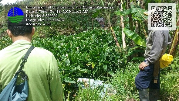
Photos from left: Management Zoning activities were supervised by Mr. Eden C. Pito, MUCEP Staff. The local guides accompanied the team in establishing the Multiple Use Zones and Strict Protection Zones. One of the agricultural products geo-tagged is the Call Lily plantation in Barangay Lake Dumingat which was then recorded under the Agricultural Zone- a sub-zone of the Multiple Use Zone.
To address present issues on zoning in the park, the DENR issued BMB Technical Bulletin No. 2018-01 “Clarifying the Procedures in the Identification, Designation and Delineation of Management Zones of Protected Areas under the National Integrated Protected Areas (NIPAS)”. Its main objective is to delineate zones/land uses within the protected area of Mt. Malindang into Multiple Use Zones and Strict Protection Zones. The delineation of the protected area is important in the proper management of Mt. Malindang in biodiversity conservation and sustainable development. It will provide basis for resource allocation and acceptable uses by considering the characteristics, benefits and potentials of the area.
The PA management zoning is a wise initiative to put all things in proper perspective. To sustain the support of park occupants and making them more effective partners in the protection and conservation of the park, it is imperative to address their concerns by implementing proper management zoning. The zoning of Mt. Malindang will establish areas where occupants can utilize the area (the multiple use zones) consistent with the various laws, and the strict protection zones which include sanctuaries of important species, geo-hazards and permanent danger areas and closed to human activities except for research and ceremonial and non-destructive uses by the Indigenous People (IP).
Prior to the actual conduct of ground survey and zoning activities, coordination and consultation workshops were conducted that were participated with concerned LGUs which was initiated by MUCEP with the assistance of the DENR. These consultations aimed to smoothly accomplish the activities of the management zoning. Alfredo F. Garrido Jr., Director of MUCEP, led the actual survey of the management zoning with the support staff from MUCEP and College of Engineering, staff from DENR-PAMO and Local residents. Forester Jersam C. Calago, the GIS specialist was responsible for generating the maps coming from the data in the field to be submitted to the DENR.
The target areas covered by the management zoning were Barangay Sebucal, Oroquieta City, Barangays Lake Duminagat, Gandawan and Lalud in the Municipality of Don Victoriano Chiongbian and Barangay Fertig Hills formerly Hoyohoy in Tangub City.
Results of the management zoning in the five barangays revealed that the multiple use zone of Brgy. Sebucal measures 15.78 km in terms of ground distance with an area of 381.6 has. This zone was further sub-divided into four (4) sub-zones namely: Eco-tourism, Settlement, Agriculture, and Trails. For Barangay Fertig Hills, the multiple use zone of the barangay was intended for the Gardens of the World which is the ecotourism site of the City of Tangub, Misamis Occidental which has a total distance of 12.36 km. x
Relative to the identified multiple use zone of the Barangay Lake Duminagat that covers a total ground distance of 14.0 km. There are four (4) sub-zones identified based on its present use to include: Eco-tourism, Settlement, Agricultural and Trails while the multiple use zone of Brgy. Gandawan measures 4.15km in terms of ground distance with an area of 30.59 has. This zone was further sub-divided into four (4) sub-zones namely: Settlement, Agriculture, Trails and Irrigation canal. Lastly, the initial area of Barangay Lalud for multiple use zone is 7.39 kilometers subdivided into 2 sub-zones namely Ecotourism and Agriculture.
The Misamis University is thankful to the DENR for funding the management zoning activities, as well as the positive support of the concerned LGUs and local communities in undertaking the activities. MU is optimistic that the generated results will help the DENR, PAMB, LGUs and local communities to propose and follow later sound decisions for better management of Mt. Malindang.
Socio-Economic Assessment and Monitoring Systems (SEAMS): Baseline Data for Protected Area Management Plan and Policies Enhancement for Mt. Malindang was spearheaded by Misamis University
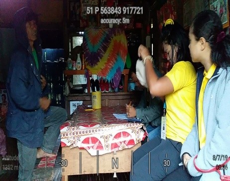
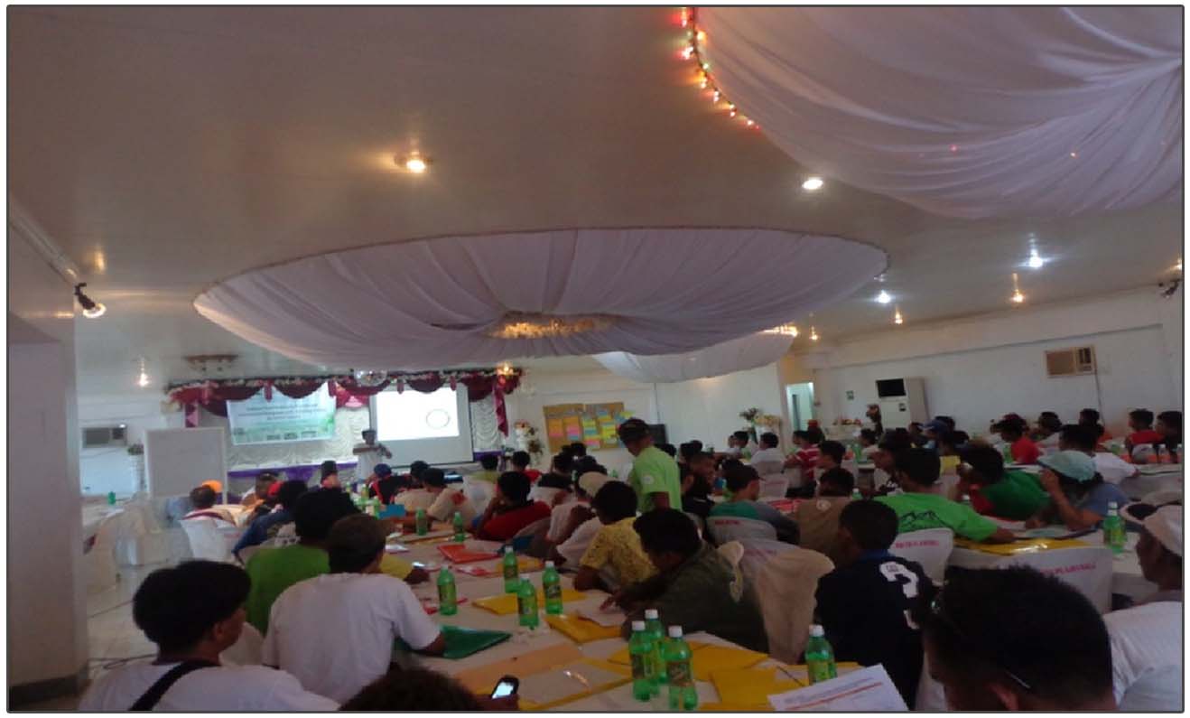
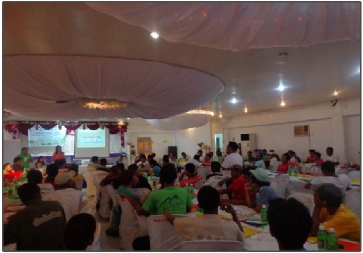
Misamis University conducted the Socio-Economic Assessment and Monitoring Systems (SEAMS) which was funded by the DENR-Protected Area Office Region 10. It was successfully completed last November 2019. SEAMS is a tool developed by the Department of Environment and Natural Resources (DENR) for the comprehensive socio-economic assessment suitable not only for terrestrial protected areas but also for coastal or marine protected areas. Through SEAMS, the Protected Area (PA) implementers will be provided with a comprehensive demographic, socio-cultural, economic, physical and institutional profile of communities in protected areas. These profiles will be presented to the PAMB for the formulation and enhancement of PA management plans and policies. The assessment was conducted in 8 barangays in the Municipality of Don Victoriano Chiongbian namely, Napangan, Tuno, Lalud, Gandawan, Nueva Vista, Liboron, Lake Duminagat, and Lampasan, and Sebucal of Oroquieta City.
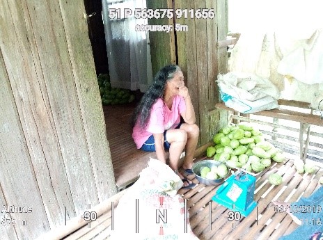
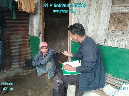
Above Left: Mrs. Virgincita Powao from Brgy. Tuno was weighing her Chayotes prior to delivery to the middle man in their barangay. Middle to right: Mr. Bobby B. Alaman was interviewing a resident in Barangay Liboron while Mr. Eden C. Pito was conducting a Focus Group Discussion (FGD) in Brgy. Gandawan on the existing threats and their causes in Mt. Malindang (right photo).
The group who conducted the assessment was spearheaded by the Misamis University Community Extension Program (MUCEP) led by the Director, Alfredo F. Garrido Jr., together with the MUCEP personnel Eden C. Pito, Bobby B. Alaman, Jersam C. Calago, Goldah Grace D. Sultan, Yunalyn L. Villantes and Hanzen D. Tomatao. Also, College of Arts and Sciences (MUCAS) and College of Business and Management (MUCBM) were involved in this project. There were also enumerators that were hired namely, Chyremar L. Caylaluad, Rutchel C. Becada, Eugene V. Villantes, Erlu J. Daguman, Kalvin Klein D. Abellar, Israel B. Calimpong, Jay Arn O. Navarro Jr., and Jayne Coleen C. Padua. The team were divided into two groups wherein the 1st group geo-tagged the existing farm lots of the residents within the PA, while the other group interviewed the household heads using the SEAMS questionnaire. The assessment covered all of the occupants inside the PA as well as those who are residing in the buffer zones and all those who are dependent on resource utilization inside the PA for subsistence and livelihood. The specific objectives of the assessment were the following: (1) to characterize the socio-economic condition of occupants in the PAs and nearby areas; (2) to identify and locate sources and values of the various ecosystems in the PAs, (3) to determine the degree of degradation/improvement in ecosystem services, uses and values, (4) to identify ecosystem pressures and threats, and their causes.
Below, left: Jay Arn, Navarro, one of the enumerators, posed with the household head from Barangay Napangan after the interview. A sticker is also visible above their head which was glued in the front portion of house that serves an indicator that the household has been interviewed and geo-tagged. Middle: Ms. Rutchel Becada and Ms. Jayne Coleen Padua, both enumerators, were interviewing a resident in Barangay Nueva Vista. Enumerators were about to go to their assigned households to conduct the interview and geo-tag the houses.
This undertaking was made possible with the continuous partnership between the Misamis University under the leadership of the dynamic President, Dr. Karen Belina F. De Leon and the Department of Environment and Natural Resources- Protected Area Office (DENR- PAO 10) led by the PENRO and Concurrent PASu Mr. Rey Fernandez. Also, the participation and support of the Mayors and Barangay Officials of the aforementioned barangays were duly recognized in making this endeavour successful.
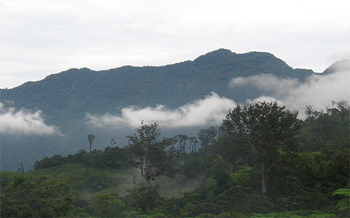
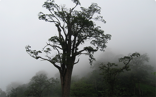
Mt. Malindang The newly-declared ASEAN Heritage Park in the Philippines
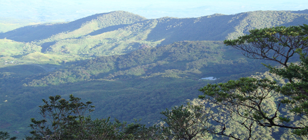
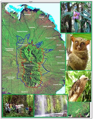
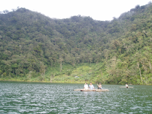
Flying over Ozamiz City in Misamis Occidental, one cannot help but see a massive mountain range that is interestingly made of forested crests, valleys and lakes. This is the Mt. Malindang Range Natural Park (MMRNP), which spans the provinces of Misamis Occidental, Zamboanga del Norte and Zamboanga del Sur.
On August 4, 2012, the ASEAN Centre for Biodiversity (ACB) designated the MMRNP as an ASEAN Heritage Park (AHP). The ACB defines AHPs as “protected areas of high conservation importance, preserving in total a complete spectrum of representative ecosystems of the ASEAN region.” The ACB establishes AHPs to generate greater awareness, pride, appreciation, enjoyment and conservation of the ASEAN region’s rich natural heritage through a regional network of protected areas.
READ MORE »
READ FROM PHILSTAR »
German Government awards grant to Misamis University to implement “Mt. Malindang Protection through Capability Development Project”
German Government awards grant to Misamis University to implement “Mt. Malindang Protection through Capability Development Project” in partnership and collaboration with the DENR-MMRNP Protected Area Management Board (PAMB), and the Provincial Government and MLGUs of Misamis Occidental.
Mt. Malindang Range Natural Park (MMRNP) is one of the Key Biodiversity in the Philippines and declared as 30th ASEAN Heritage Park in 2011. It is a watershed that provides water for industrial, commercial and domestic water supply to the estimated 566, 000 residents of Misamis Occidental, and irrigation systems to an estimated 8, 296has of ricelands in the province.
Despite its richness in natural resources, it is faced with several issues and problems such as threatened biodiversity, lack of baseline and comprehensive data on resources, lack of integrated ecosystem-based protection, conservation and rehabilitation plans; declining number of endemic species; timber poaching and illegal wildlife gathering and trading; unsustainable farming practices and limited means of livelihood; and low environmental awareness. The foregoing reasons prompted Misamis University Community Extension Program Director, Ms. Grace V. Villanueva, to submit a proposal for a project entitled as Mt. Malindang Biodiversity Protection through Capability Building to the Duetsche Gesselschaft fur International Zusammenarbeit (GIZ) – Protected Area Management Enhancement (PAME) Project. The proposal was approved on December 2014 and implemented this year.
 The project Mt. Malindang Biodiversity Protection through Capability Building objectives are to sustain Mt. Malindang ecological services to the people of Misamis Occidental and eastern part of Zamboanga Peninsula and threats of Mt. Malindang reduced. It is supported by the Duetsche Gesselschaft fur International Zusammenarbeit (GIZ) – Protected Area Management Enhancement (PAME) project and a collaboration of Misamis University with the Department of Environment and Natural Resources (DENR) –MMRNP Protected Area Management Board (PAMB) through the Protected Area Office (PAO) and the Provincial Local Government Unit and Municipal Local Government Units of Misamis Occidental. The total budget support from the GIZ- PAME amounts to Php 1, 469, 650.00, with the counterparts from partner offices such as DENR-PAO with Php 1, 133, 300.00, Prov. Gov. of Mis. Occ. with Php 1, 037, 500.00, and Misamis University amounting to Php 334, 080.00, on the other hand, MLGUs and Barangays counterparts to the project are in kind, transportation, personnel and others.
The innovations* of the project includes the re-training of Bantay Lasang which will enable them acquire competency to conduct assessment and identify economically important, indicator, endangered, endemic, and even invasive species in their very own communities, thereby, giving them actual, tangible data, proof and confirmation of the biodiversity they should protect, and as basis for planning, and precise accountability during monitoring and evaluation. The enlistment of BPATs will widen the protection base/social fence of MMRNP by increasing the number of persons directly concerned and accountable for Mt. Malindang protection. .
Another innovative component of the project will be the integration of Barangay E-Environmental Protection Management System to MMRNP Biodiversity Monitoring System. This project component will be with the Misamis University College of Computer Studies (CCS). This measure reinforces and adds valuable locally generated information to the system, with protection plans supported by local ordinances and legislations. The use of technology in the protection, monitoring, and evaluation for biodiversity protection and environmental management through installation of the system whereby community based field operations from 11 municipalities and 3 cities are linked to electronic database: GIS, Geo-tagging will strengthen MMRNP natural resources management, including efficient and effective enforcement.
The project, an initiative on public and private-academe partnership for biodiversity protection and environmental management will combine the scientific and technological expertise of the academe, the real world experiences of the communities, and the resources, mandate, knowledge and authority of agencies and LGUs to eventually address the threats to the very valuable biodiversity of Mt. Malindang.
Evidence Based Biodiversity Protection and Environmental Management
The Evidence Based Biodiversity Protection and Environmental Management is one of the components of the GIZ-PAME project named Mt. Malindang Biodiversity Protection through Capability Building granted to Misamis University Community Extension Program (MUCEP) in collaboration with the Department of Environment and Natural Resources – Protected Area Office 10 (DENR-PAO) and Provincial Local Government Unit of Misamis Occidental (PLGU). Misamis University has successfully conducted the Evidence Based Biodiversity Protection and Environmental Management training of the 130 Bantay Lasang (BLs) and 325 Barangay Peacekeeping Action Team (BPATs) of the 65 buffer zone barangays of Mt. Malindang Range Natural Park (MMRNP) in Misamis Occidental. The training consisted of five topics which are vital in conducting the resource-based assessment on the environmental and critical condition of Mt. Malindang. These topics are the Basic Measures and Measurements, Global Positioning System (GPS) Reading, Flora Assessment, Fauna Assessment, and Focus Group Discussion. The resource persons are Forest Engr. Alfredo Garrido, faculty from the College of Agriculture and Forestry, For. Jersam C. Calago, Project Officer from Misamis University Community Extension Program (MUCEP), Ms. Yunalyn Villantes and Ms. Russel Galindo, faculty from the College of Arts and Sciences. The capability building was held at Asian Hotel, Ozamiz City last March 25-27, 2015.
The training was designed to utilize community resource based inventory assessments as the primary tool in understanding the importance of biodiversity in Mt. Malindang. The capability building of Bantay Lasang and enlistment of Barangay Peacekeeping Action Team (BPATS) will strengthen and widen the protection base and social fence of MMRNP. The innovation in the conduct of community based resource assessment by the BLs and BPATs will show the evidence-based actual exposure to the types, classes, quantity of the biodiversity they will protect.
The first two (2) days of the training was the introduction of the five topics crucial to the actualization of the evidence-based resource assessment by the BLs and BPATs to the types, classes and quantity of the biodiversity they will protect and to enlighten them on their role being accountable to the resources they will record and plan to protect. On the third day of the training, the BLs were immersed to Bukagan Hills, Malaubang Ozamiz City where they were able to practice the assessment of flora and fauna by applying the transect walk and field diary and used the GPS in recording the coordinates of the resources they will protect.
Misamis University targets children of Carangan Creek
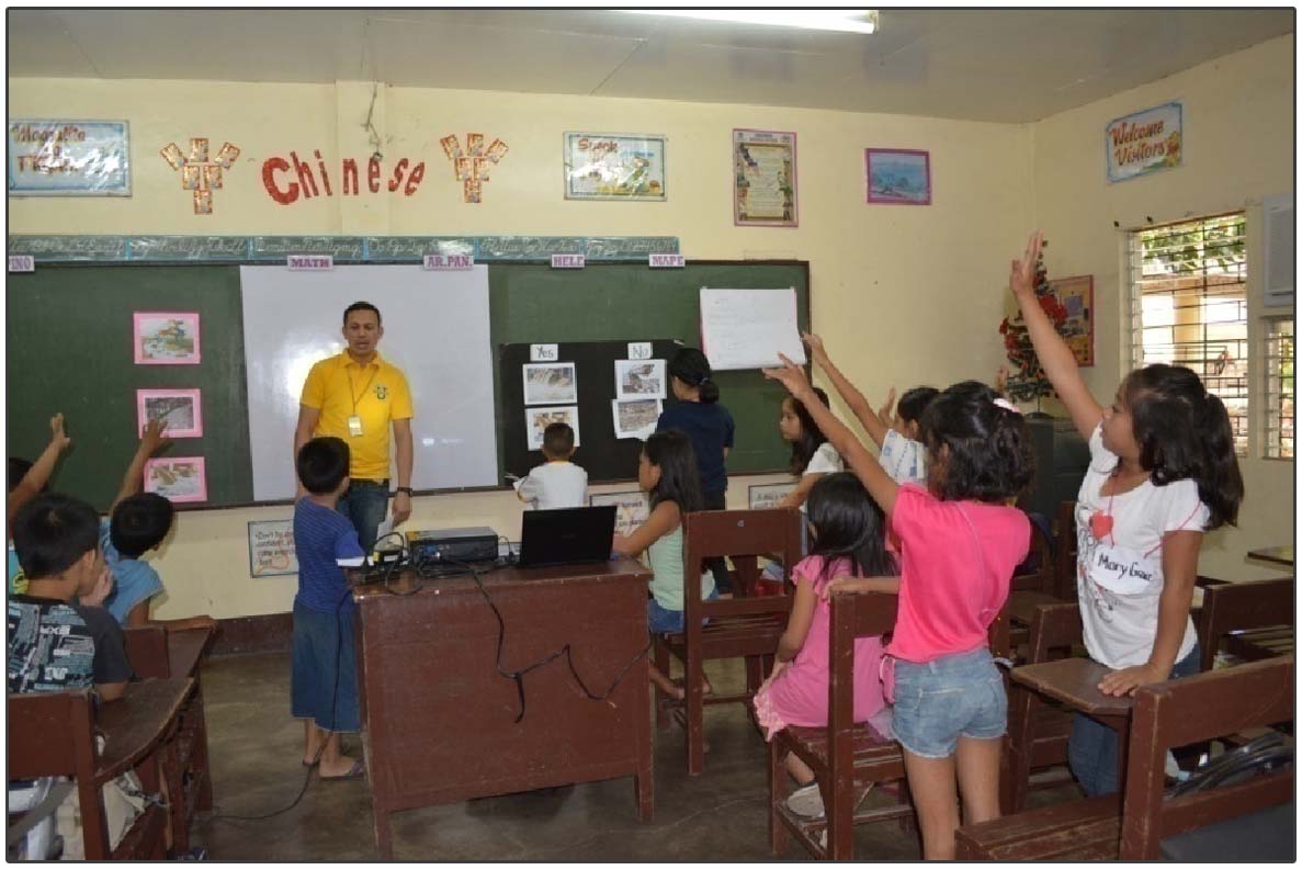
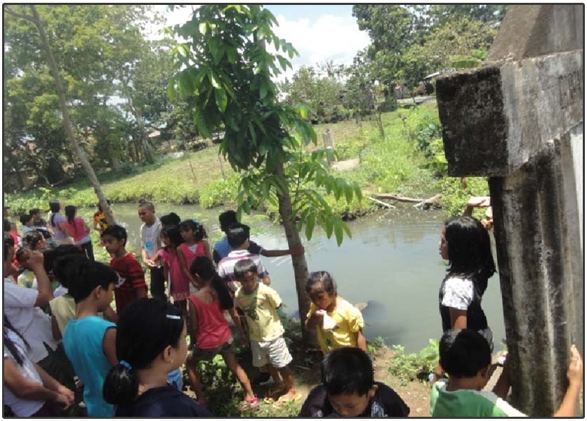
Ecological Strengthening through Environmental Rehabilitation and Orientation (ESTERO) program is an initiative developed by Misamis University Community Extension Program (MUCEP) in response to the Adopt-an-Estero program of Department of Environment and Natural Resources (DENR) in partnership with the Local Government Unit of Ozamiz City that is geared towards the rehabilitation of the creeks in Ozamiz City. One of the activities designed for the ESTERO program is the Environmental Classes for Children (ECC). It is basically designed to educate the children aged 5-16 years old living along Carangan Creek on the fresh water, water cycle and the importance and functions of creeks and the ways to rehabilitate it. This activity was spearheaded by Misamis University Community Extension Program (MUCEP), with the invaluable support from the Grade School Department Faculty and National Service Training Program (NSTP) Coordinators who facilitated the classes. These 2-day classes was held on April 20-21, 2015 at Misamis University Grade School Department with 85 attending children out of 120 listed participants from barangays Carangan, Lam-an, 50th Barangay, and San Roque. This endeavor was supported by the Misamis University National Training Program and Elim Magnolia Chicken Distribution who generously donated lunch for the participants.
The participants were divided into groups according to ages 5-7, 8-9, 10-11, and 12-16. During the first day, they were able to define the fresh water and water cycle and its importance to our daily lives. Moreover, varied activities were incorporated in the discussion such as group discussion, fish tank demonstration, water cycle role playing, board games using cartolina strips, identifying a clean and dirty creek with the use of pictures and showing of video clips of creeks. Each activity awaited school supplies as prizes donated by the National Service Training Program students.
On the second day, students were enlightened on the importance and functions of creek and proper waste disposal. Moreover, in the afternoon, the participants were toured to Carangan Creek from the source in Brgy. Carangan to its estuarine in Brgy. San Roque. After the tour, the kids were able to rate and compare the situation of the creek in each barangay from one another through the Carangan Creek Health Sheet that provided them categories they are going to rate. Mostly, their rating on the Carangan Creek was very low which indicates that the situation of our Carangan Creek is bad. On April 22, 2015, the participants marched on the stage as they received their Certificates of Completion, attended by MUCEP personnel, DENR EMB 10 Senior Specialist Ms. Teresa M. Digamo, NSTP Director Dr. Virgilio H. Onganiza, and MU Grade School Principal Ms. Analyn Clarin and faculty of Grade School Department.
The Subanen celebrate nature and life on Mt. Malindang
To the Subanen, Mt. Malindang Range Natural Park, which spans the provinces of Misamis Occidental, Zamboanga del Sur and Zamboanga del Norte in Mindanao, is home. Long considered the first caretakers of this mountain environment, the Subanen expressed pride in their ancestral domain and in its declaration as an ASEAN Heritage Park.
The Subanen (read as Suban-ons) are the indigenous peoples of the mountainous areas of the Zamboanga Peninsula, Mindanao, Philippines. They are divided into five sub-groups: Central Subanen, Northern Subanen, Koligugan Subanon, Western Subanon and Southern Subanun, each with its own dialect and geographical area. They derive their name from the Visayan word “suba” meaning river, and are thus known as the people who live along the river. The name Subanen can also be traced to Subayen (read as Subayon), another Visayan word “subay,” meaning looking through.
Mt. Malindang is considered the ancestral domain of the Subanen, who comprise 75 percent of the occupants of the park. Fernando M. Magante, Provincial Tribal Coordinator for the Subanen, relates that the Mt. Malindang is considered sacred ground by the tribe. “Wala pa ang Malindang, nandito na ang Subanen,” he relates. The Subanen believed that nature was a gift from God. “Lahat ng gawa ng Diyos, ay hindi pag-aari ng tao.” They enjoy an intimate relationship with nature, and take only what is needed. “Bawal angkinin ang lupa, at ang pagtanim ay para lamang sa pagkain.” The Subanen survived on the bounty of Mt. Malindang, the forests of which thrived with fruit, honey, deer, wild boar, and other wildlife.
READ MORE »